MAPS.ME is a mobile navigation application for iPhone and Android, built on top of crowd-sourced OpenStreetMap data. The application is a source for offline maps to help users who need to navigate areas with limited internet connection. The attributes of the offline maps will be critiqued based on design principles from Don Norman’s book, “Design of Everyday Things”.
First Launch: Downloading Offline Maps
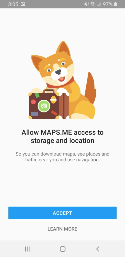
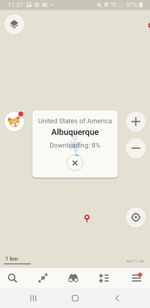
Upon first launch, the application asks for access to the GPS/location function and storage of the user’s device in order to download maps. This introduction provides users with the understanding that they need to initially be online to pre-install offline maps.
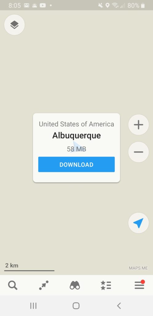
Next, the application should automatically detect the device location and prompt the user to download the map and data for that area. It will tell the user how much space the map would require on the device.
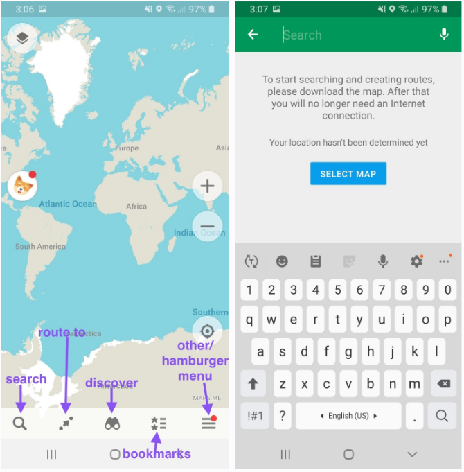
This first prompt acts as a feedforward or tutorial explaining that maps need to be downloaded first to start using it. Even without this prompt, the interface is simple to understand and cluster free, as there are only the GPS and zoom icons on the map. There are signifiers for “search”, “route to”, “discover”, “bookmarks”, and “other/hamburger menu” controls at the bottom of the screen. The mapping of the bottom control options lists “search” as the very first option from the left, making it likely for users to click “search” first and see the text instructions to download their maps. Users will then be asked to select their country of preference, and the application will start downloading the map.
Downloading maps can sometimes take a few minutes depending on the size of the map, but there is immediate feedback on how much time is remaining for the download. The offline maps will always be available on the device after download.
Navigation
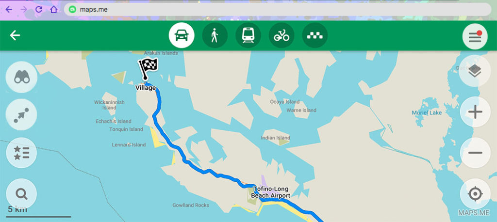
The downloaded maps are compressions of the map data from OpenStreetMap, a community-based map that anyone can freely edit and contribute to. The vast data including a large number of hiking trails which are otherwise difficult to find on other map applications can still be navigated and searched through offline. Clicking “route to” will give users directions to a place.
The application will show the distance to the destination and how long it would take to get there by either driving, cycling, or walking. Clicking “start” will initiate the turn by turn navigation, which can be switched off or muted by the user. An arrow cursor will appear to map the user’s movement.
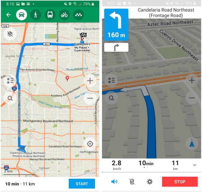
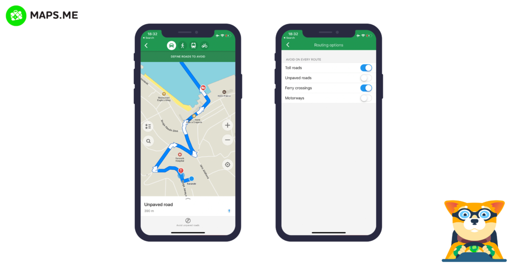
One issue with the navigation would be that the application always selects the quickest route possible, without taking into consideration road constructions or hills. There is no satellite view in MAPS.ME, and overlays of subway lines, traffic, terrain, or local guides can only be viewed with internet connection. To overcome unexpected travel conditions while being offline, the application can provide more options of routes.
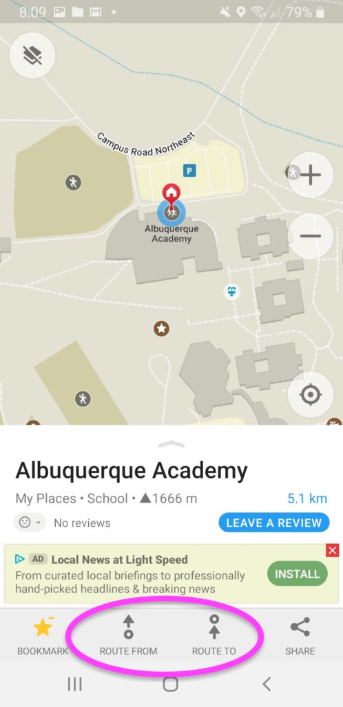
Searching and Bookmarking Places
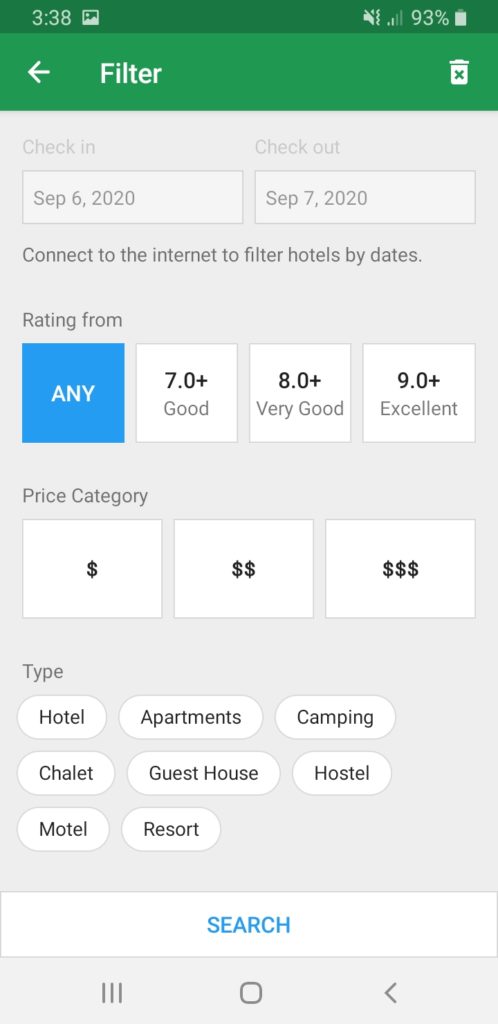
Users can look up a place by entering its address, name, keyword, or coordinates in the “search”. The smart search tool will appear when looking for accommodations, acting as a conceptual model that enhances the search ability with filters of type, ratings, price, and date.
Tapping the star button at the bottom of the screen will bookmark a place, and mark the location with a red pin on the map. Every bookmarked place can be edited with custom names or sorted into categories, reducing the chances for users to make a mistake or slip.
The GPS navigation allows the application to track and share the current locations (by tapping the cursor on the map, or selecting “share my location” from the “hamburger menu”), making it possible for users to map out custom locations.
Sometimes it is easier to research for a trip looking at a larger screen of a computer instead of a phone. Unfortunately, MAPS.ME does not have its own web interface, and everything can only be done on the phone. Although there is apparently a feature to import bookmarks from other map applications if it is in the kml/kmz file format, this affordance is not discoverable anywhere on the application. Either explaining this import feature in the “bookmarks”, or having a web interface will allow more flexible use of the map.
Conclusion
The application has an easy to use interface with customizable data and offline stability, which makes it extremely useful for users with limited online connection, in areas where roaming is not available, or in need to save data. The offline maps can further be improved if more advanced features are added, such as different views, multiple route options, details for some places, and a web interface. However, that may result in a larger map file to download.