Navigating the MTA can be stressful for anyone, but it can be especially challenging for people who are blind or have low vision. Subway systems rely heavily on visual signs, maps, and platform indicators. Missing one sign can mean getting lost or boarding the wrong train.
Navilens is an assistive technology in transit systems like the MTA to make navigation more accessible. Using colorful, high-contrast markers that can be scanned with a smartphone camera, Navilens provides audio instructions about where you are and where to go supporting independent movement through a public environment that has traditionally relied on vision.
Long-Distance Scanning
People who are blind or have low vision can access NaviLens code by a smartphone camera that can be detected from great distances, even while the user is in motion. Once detected, the app provides haptic vibration and audio cues to guide the user. A single marker can be detected from up to 60 feet away, roughly 12 times farther than a standard QR code. The technology works at wide angles of up to 160 degrees, meaning a visually impaired user does not need to know the code’s exact location to scan it.
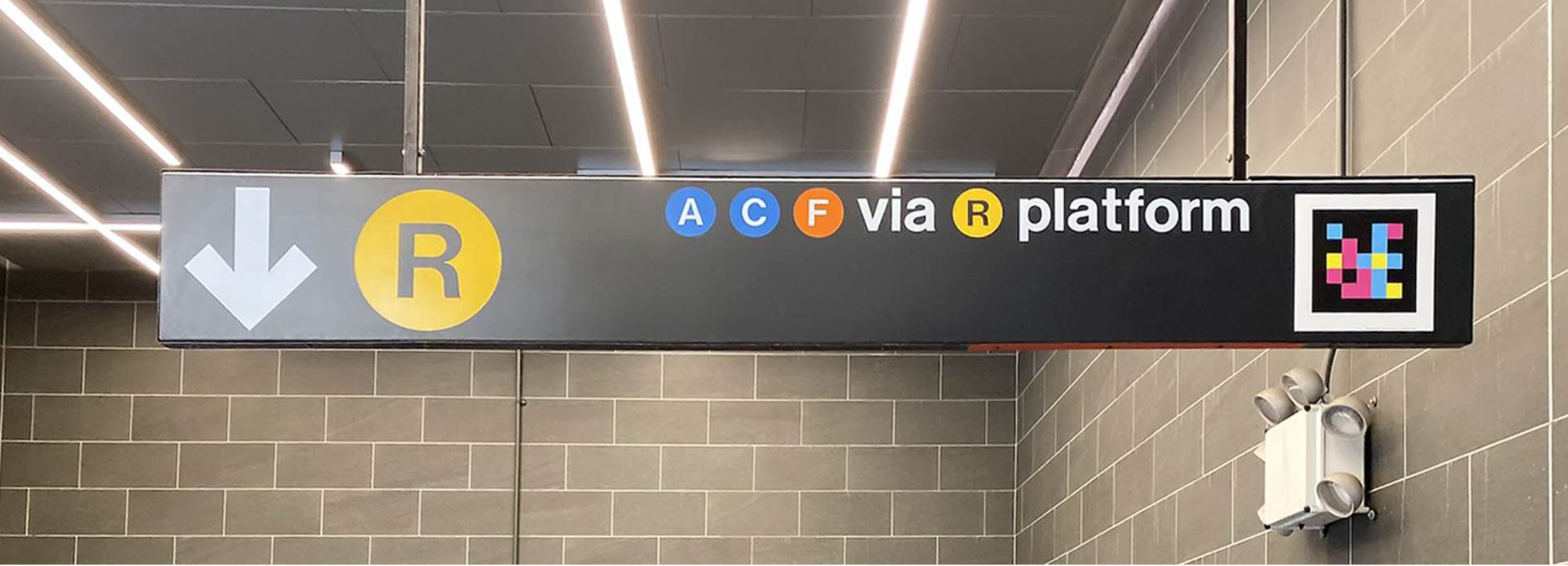
From a social model perspective, this shifts the problem from the user’s sight to the station’s design. By placing over multiple NaviLens codes at locations like 59 St-Columbus Circle, the MTA changes the system to accommodate a range of human ability. Rather than expecting blind riders to adapt to a visual environment, the transit system takes responsibility for communicating information in ways that don’t require vision.
It can also be viewed through a functional model, since it identifies a specific barrier, finding directions in a complex station, and removes it through technology. Instead of relying on memory or assistance from others, a blind or low vision rider can independently locate exits, platforms, and bus stops using the app.
Navilens moves away from the Charity/Tragedy model that views people who are blind and have low vision as a pity and treats navigation as something achievable independently.
Audio Directions
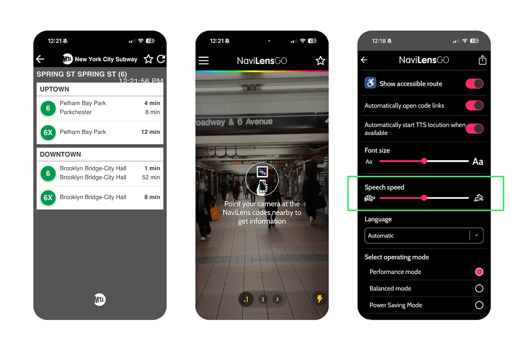
NaviLens also provides audio directions. When a user opens the app and points their phone camera, the system detects markers from a distance and reads out relevant information. For someone who is blind or has low vision, this allows knowing which direction leads to the downtown platform or where the nearest exit is, without asking a stranger for help.
This feature can be viewed through the social model of disability, which suggests disability is often caused by poorly designed environments rather than an individual’s impairment. Transit systems that rely only on visual signage create barriers. By providing audio navigation through the environment itself, NaviLens shifts the focus away from a person’s inability to see and toward the system’s responsibility to communicate information in multiple ways.
It can also be viewed through a functional solutions model. This model focuses on identifying specific task barriers and removing them through technology. In this case, the barrier is locating directions and understanding spatial information through audio in a busy station. NaviLens provides a practical solution that allows a blind rider to navigate independently without relying on memory or assistance.
Conclusion
NaviLens shows how accessible design can improve everyday transit experiences. By integrating long-distance scanning and audio navigation, the system challenges the medical model’s view that disability is a biological problem that needs to be fixed. Instead, it adopts the social model, recognizing that riders are not disabled by their lack of sight, but by a transit environment that has historically relied on visual communication. This technology moves the MTA away from a charity/tragedy perspective, where blind riders must rely on the pity or assistance of strangers, and toward a functional model approach that prioritizes independence. By embedding accessibility into public infrastructure rather than treating it as an add-on, NaviLens moves the MTA toward a transit experience that supports a wider range of riders navigating the city independently.
References
“Accessibility Innovations: NaviLens.” Metropolitan Transportation Authority, www.mta.info/accessibility/innovations/navilens. Accessed 10 Feb. 2026.
Lighthouse Guild. “Tech for Transit: Navigating the MTA with NaviLens.” YouTube, uploaded by Lighthouse Guild, https://youtu.be/lBJLgJFTROw . Accessed 10 Feb. 2026.
“NaviLens.” NaviLens, www.navilens.com/en/. Accessed 10 Feb. 2026.
User Manual NaviLens 2024. Association of Programs for Rural Independent Living, 2024, www.april-rural.org/conference/images/2024_Conf/User_Manual_NaviLens_2024.pdf. Accessed 10 Feb. 2026.